Category:Great Lakes Areas of Concern
Jump to navigation
Jump to search
English: Great Lakes Areas of Concern are designated geographic areas within the Great Lakes Basin that show severe environmental degradation.
geographical region in the Great Lakes that show environmental degradation | |||||
| Upload media | |||||
| |||||
Media in category "Great Lakes Areas of Concern"
The following 37 files are in this category, out of 37 total.
-
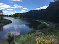
 12 Foot Falls Park, Dunbar Wisconsin.jpg 2,016 × 1,512; 1.71 MB
-
 Asian Carp Monitoring.jpg 2,560 × 1,920; 1.25 MB
-
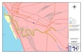 Buffalo River - final state approved.pdf 2,550 × 1,650; 545 KB
-
 Cuyahoga River - final state approved-201007.pdf 2,550 × 1,650; 482 KB
-
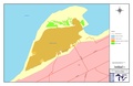
 Detroit Area of Concern in 2012.jpg 4,256 × 2,832; 4.23 MB
-
 Dredging at Howards Bay.jpg 3,024 × 4,032; 2.04 MB
-
 Dredging in Otter Creek in the Maumee Area of Concern.jpg 3,024 × 4,032; 4.6 MB
-
 Dredging in the Ashtabula Area of Concern.jpg 3,072 × 2,304; 3.96 MB
-
 EPA and Partners Planting in Ashtabula.jpg 2,336 × 3,504; 2.31 MB
-
 EPA Boat at Scanlon Reservoir.jpg 3,264 × 2,448; 2.05 MB
-
 EPA Federal Partner Holding a Lake Sturgeon.jpg 3,821 × 2,547; 1.03 MB
-
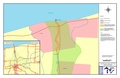 EPA map of Eighteen Mile Creek - final state approved.pdf 2,550 × 1,650; 516 KB
-
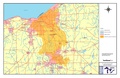
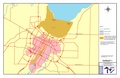
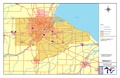
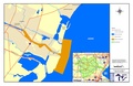
 EPA map of Michigan's River Rouge - aocmapv2.pdf 1,531 × 958; 158 KB
-
 EPA map of Presque Isle Bay - final state approved.pdf 2,550 × 1,650; 502 KB
-
 EPA map of the Buffalo River - final-state-approved 1.gif 1,223 × 792; 135 KB
-
 EPA map of the Fox River and Green Bay final state approved.pdf 2,550 × 1,650; 345 KB
-
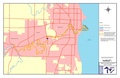
 EPA map of the Kalamazoo River - final state approved.pdf 2,550 × 1,650; 992 KB
-
 EPA map of the Manistique River - final state approved.pdf 2,550 × 1,650; 770 KB
-
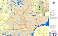
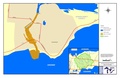
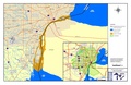
 EPA map of the Maumee River - final state approved.pdf 2,550 × 1,650; 185 KB
-
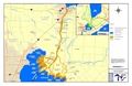
 EPA map of the Menominee River aoc boundary.pdf 2,550 × 1,650; 750 KB
-
 EPA map of the Sheboygan River - final state approved.pdf 2,550 × 1,650; 468 KB
-
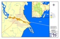
 EPA map of the St Clair River - final state approved.pdf 2,550 × 1,650; 253 KB
-
 Great Lakes Detroit Shoreline.jpg 4,256 × 2,832; 2.86 MB
-
 Great Lakes Sunset on EPA's Research Vessel.jpg 4,032 × 3,024; 1.73 MB
-
 Lake Michigan from Gary, Indiana.jpg 4,032 × 3,024; 2.45 MB
-
 Lake Michigan Shoreline in Chicago.jpg 4,032 × 3,024; 1.26 MB
-
 Lincoln Park Restoration.jpg 1,067 × 800; 234 KB
-
 Map of Michigan's River Raisin final state approved.pdf 2,550 × 1,650; 805 KB
-
 Map of the Detroit River final state approved.pdf 2,550 × 1,650; 1.05 MB
-
 Overflight of the Detroit Area of Concern.jpg 4,256 × 2,832; 4.99 MB
-
 Purple Martins at Beaver Island.jpg 1,177 × 1,532; 368 KB
-
 Remediation in Lake George.jpg 400 × 195; 16 KB
-
 Skyline of Toledo, Ohio with view of the Maumee River Area of Concern.jpg 1,394 × 1,010; 370 KB
-
 Turns Returning to Interstate Island.jpg 1,176 × 882; 267 KB
-
 View of the Great Lakes from on top of a Sand Dune.jpg 4,032 × 3,024; 2.6 MB
-
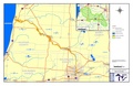
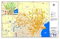 Watershed of Michigan's Clinton River - final state approved.pdf 2,550 × 1,650; 881 KB
-
 Zephyr Dredging.jpg 4,288 × 2,848; 3.03 MB


